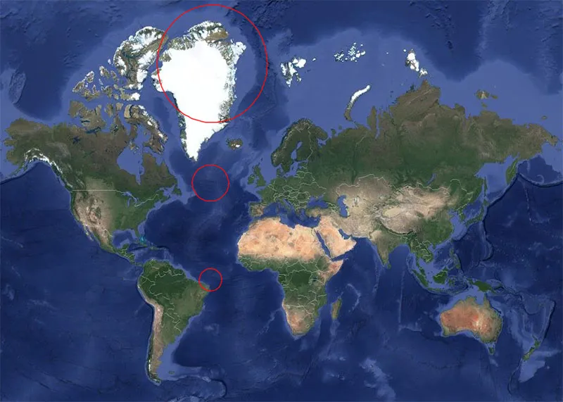
The Mercator projection is a cylindrical map projection presented by Flemish geographer and cartographer Gerardus Mercator in 1569. It became the standard map projection for navigation because of its unique property of representing any course of constant bearing as a straight segment. As with any map of the world, the Mercator projection makes representational … [Read more...] about Every Circle on This Map Has the Same 500 Mile Radius
enthusiasm for knowledge

Footer
Bom Boh
We Love Animals give you the news that truly matters to you. Read, look and share the things you are interested in. Welcome!
Recent
- The “World’s First Cruise Liner” Was Designed by Archimedes
- What Will Be The Last Living Thing On Earth?
- California photographer swims with giant, alien-like sea creature
- Hunter Kills First Gray Wolf Seen In Lower Peninsula Of Michigan For 100 Years
- Hiker finds massive ‘beast’ hiding along banks of South Carolina creek