
Introduction
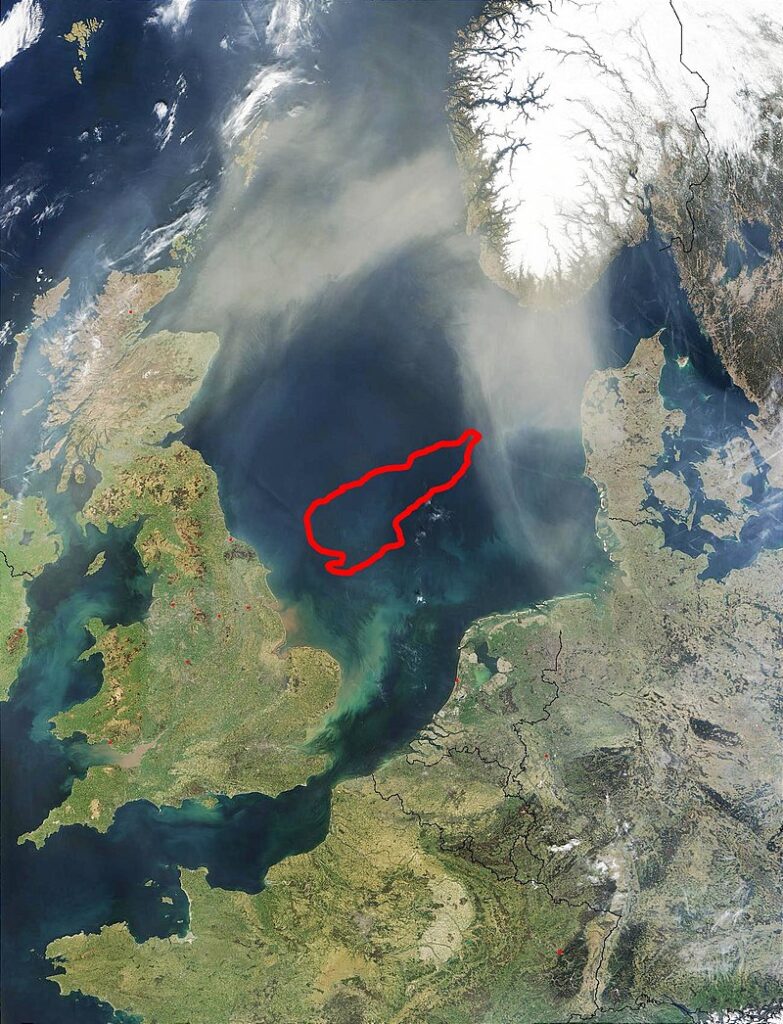
Doggerland, a lost realm beneath the waves of the North Sea, presents a captivating tale of an ancient connection between Britain and continental Europe. Submerged around 6500–6200 BCE due to rising sea levels, this Mesolithic haven has intrigued scientists and historians alike. Join us as we journey through time, unraveling the mysteries of Doggerland’s rich past and the forces that reshaped its landscape.
The Mesolithic Marvel
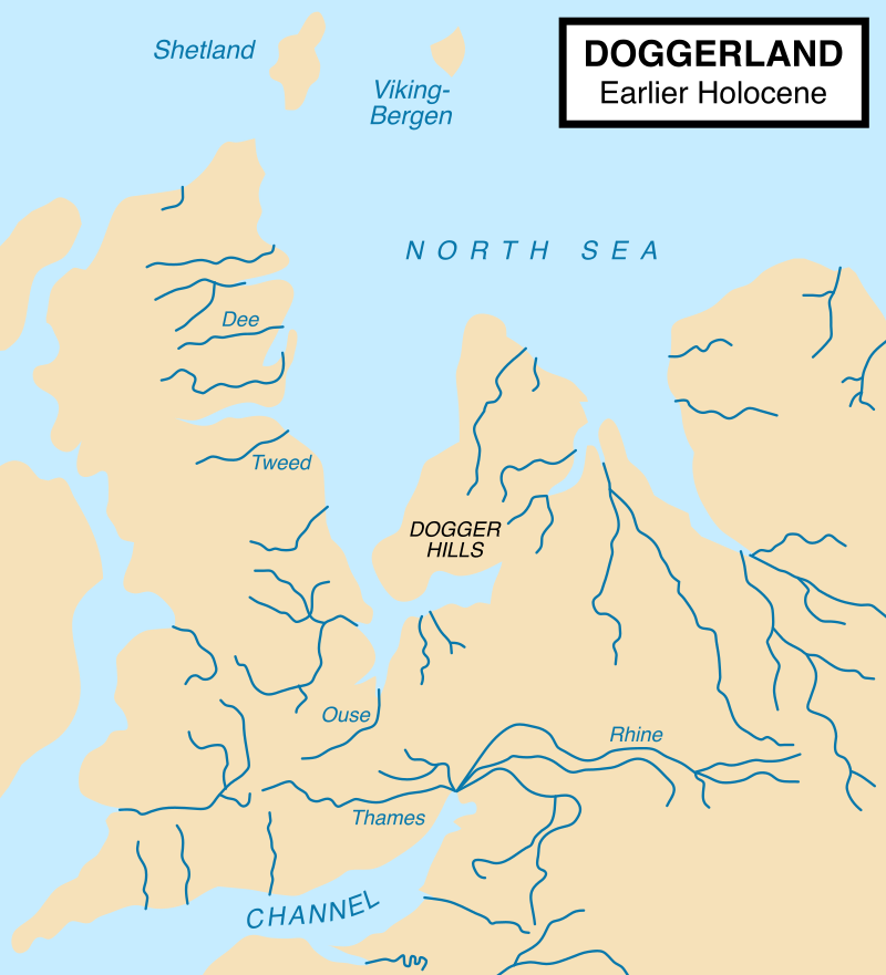
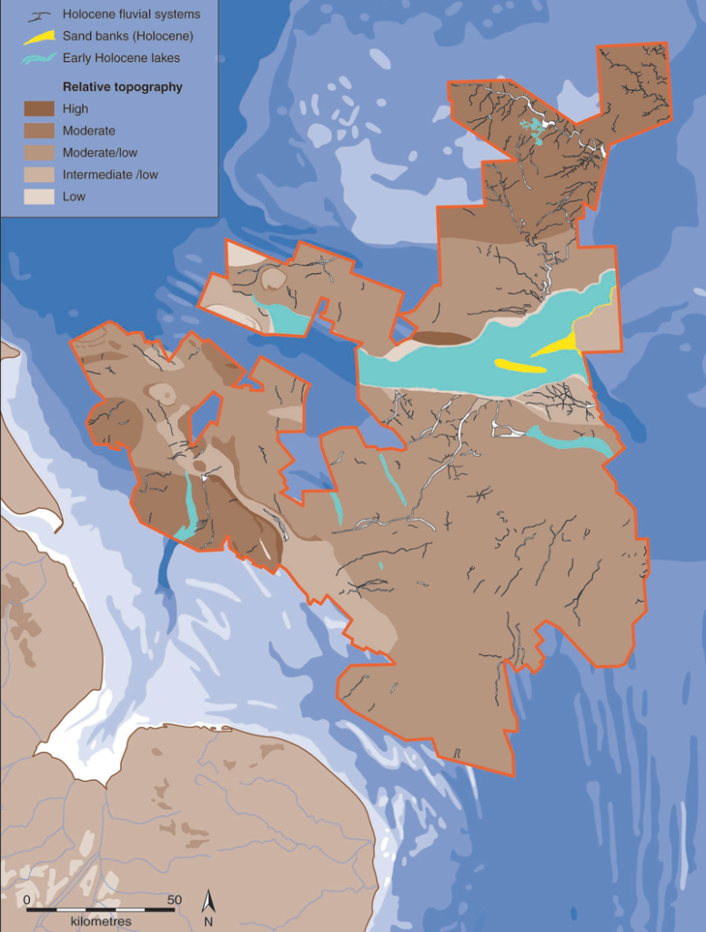
Doggerland was more than just a geographical link; it was a vibrant habitat teeming with life during the Mesolithic period. Stretching from present-day Great Britain to the Netherlands, Germany, and Denmark, this landmass supported a diverse ecosystem and likely harbored human habitation. Lagoons, saltmarshes, mudflats, and beaches, along with inland streams, rivers, and lakes, contributed to its allure as a prime hunting, fowling, and fishing ground.
A Catastrophic Transition
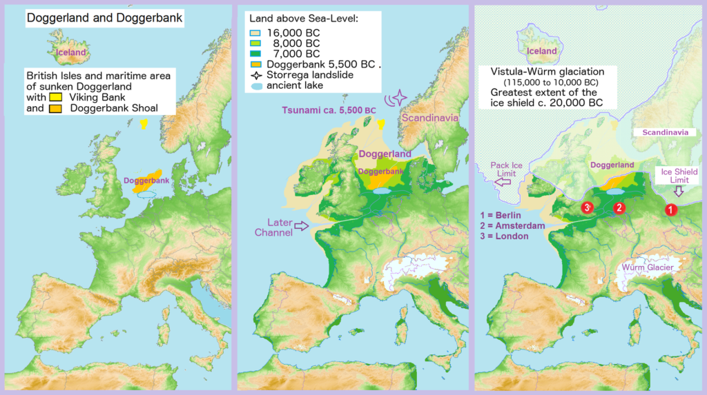
The demise of Doggerland was a result of a sequence of geological events. Rising sea levels gradually transformed it into a cluster of low-lying islands. The final blow may have come from a tsunami triggered by the Storegga Slide, a submarine landslide off the coast of Norway. This catastrophic event, occurring around 6200 BCE, is believed to have dealt a devastating blow to the coastal Mesolithic population, marking the definitive separation of Britain from the continent.
Unearthing Ancient Secrets
Modern advancements in technology have rekindled interest in Doggerland’s enigmatic past. Archaeologists are employing a blend of new and traditional techniques, including archaeo-geophysical methods, computer simulations, and molecular biology, to shed light on this submerged landscape. Their efforts are illuminating past environments, ecological changes, and the transition of human societies from hunter-gatherers to farming communities.
Unlocking the Geographical Evolution
Doggerland’s transformation was a gradual process influenced by shifting landscapes and geological factors. During the Last Glacial Maximum, approximately 18,000 years ago, much of the British Isles, including Doggerland, was covered by glacial ice, and sea levels were considerably lower. As the climate warmed, Britain and its surrounding areas transitioned into a tundra-like expanse. The landscape gradually evolved, with rivers such as the Seine, Thames, Meuse, Scheldt, and Rhine creating a complex network that eventually flowed westward into the English Channel.
A Submerged Legacy
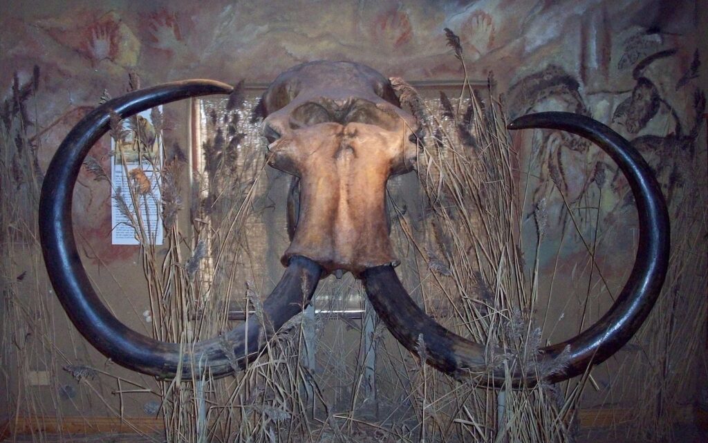
The archaeological potential of Doggerland was recognized in the early 20th century, and since then, various artifacts and remains have surfaced, offering tantalizing glimpses into its prehistoric past. A barbed antler point, mammoth and lion remains, and even evidence of early human tools have all been retrieved from its depths. These discoveries provide valuable insights into the lives of ancient inhabitants and the creatures that roamed this lost land.
Continuing the Quest
In recent times, international teams have redoubled their efforts to investigate Doggerland’s submerged secrets. The use of cutting-edge techniques has enabled researchers to reconstruct its flora, fauna, and the lives of its inhabitants. As the University of Bradford’s Europe’s Lost Frontiers project continues to map the prehistoric landscapes of Doggerland, new data emerges, enhancing our understanding of this intriguing chapter in human history.
Conclusion
Doggerland’s story serves as a poignant reminder of the impermanence of landscapes and the enduring quest of humanity to understand its past. Through a blend of scientific inquiry, technological innovation, and a deep curiosity about our origins, researchers are piecing together the tale of a lost world that once bridged nations and cultures. As we navigate the present and look to the future, the submerged land of Doggerland continues to inspire awe and wonder, inviting us to explore the depths of history that lie beneath the surface of our modern world.
Leave a Reply